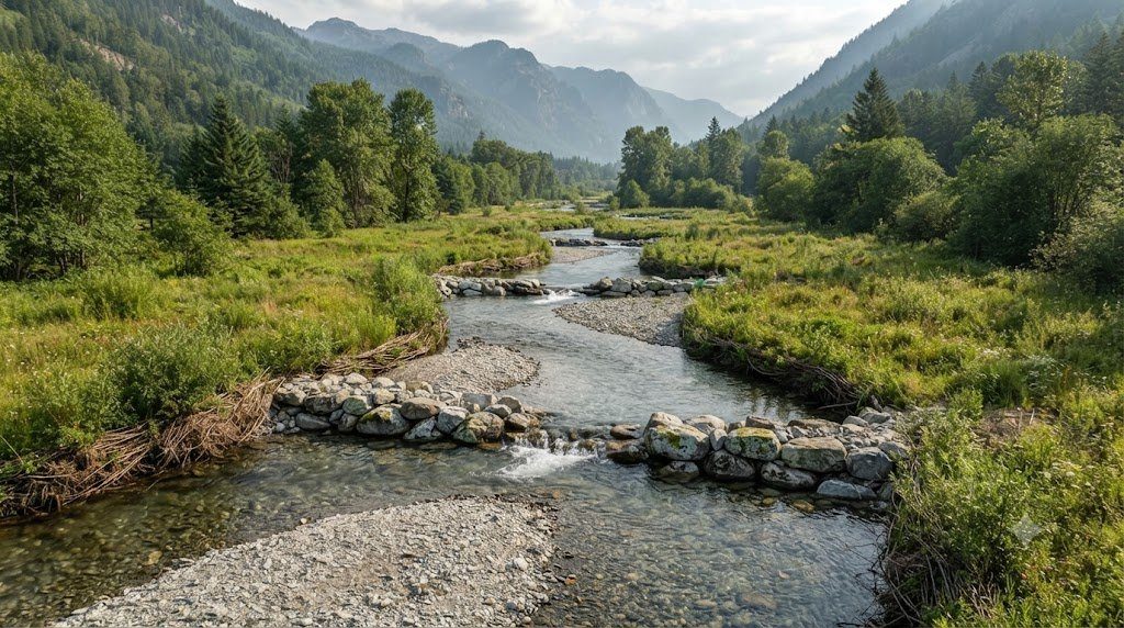
When rivers are subjected to human channelization—straightened, dredged, and armored with concrete rip-rap to expedite agricultural drainage or urban development—they almost universally destabilize. Stripped of their natural sinuosity, channelized rivers experience steepened gradients, escalated boundary shear stresses, and severe bed degradation (incised ‘gullying’), which drops groundwater tables and triggers massive bank collapses. In response to widespread engineering failures, hydrologist Dave Rosgen developed the Rosgen Stream Classification System in the 1990s, pioneering the discipline of Natural Channel Design (NCD).
By categorizing river reaches based on objective quantitative morphometric measurements—including entrenchment ratio, width-to-depth ratio, sinuosity, channel slope, and bed particle size distribution—the Rosgen system provides river engineers, limnologists, and watershed managers with a predictive taxonomy for assessing channel stability, sediment transport capacity, and ecological restoration potential.
The Hierarchical Levels of Rosgen Geomorphic Classification
The Rosgen classification operates across four progressive hierarchical levels of increasing detail, moving from macro-scale valley landforms down to site-specific velocity profiles:
- Level I (Geomorphic Characterization): Broad landscape-scale assessment based on topographic maps and aerial imagery, classifying valleys into basic canyon, mountain slope, alluvial terrace, or coastal plain landforms.
- Level II (Morphological Description): The core field classification level, requiring precise cross-sectional surveying at the bankfull stage to assign a letter type (A through G) and a numerical substrate suffix (1 through 6).
- Level III (Stream Condition Assessment): Field evaluation of riparian vegetation vigor, bank erosion potential, large woody debris loading, and sediment deposition patterns.
- Level IV (Field Verification & Validation): Empirical measurements of sediment bedload transport rates, bank migration rates, and acoustic Doppler flow velocities over multiple seasons.
The Five Core Morphological Metrics of Level II Classification
To classify any river reach under Level II, a field hydrologist must survey an unobstructed riffle cross-section and compute five mathematical parameters at the Bankfull Stage:
- Entrenchment Ratio ($ER$): The ratio of the Flood-Prone Area Width ($W_{fpa}$) to the Bankfull Width ($W_{bkf}$): $ER = W_{fpa} / W_{bkf}$. The flood-prone width is measured horizontally across the valley at an elevation equal to twice the maximum bankfull depth ($2 \times D_{max}$). An $ER < 1.4$ indicates an entrenched, incised channel; an $ER > 2.2$ indicates a well-connected, unentrenched channel with an expansive floodplain.
- Width-to-Depth Ratio ($W/D$): Bankfull width divided by mean bankfull depth: $W/D = W_{bkf} / D_{mean}$. A $W/D < 12$ indicates a deep, narrow cross-section; a $W/D > 12$ reflects a wide, shallow channel.
- Sinuosity ($K$): Stream length along the thalweg divided by straight-line valley distance: $K = L_{stream} / L_{valley}$. Values range from 1.0 (straight) to >1.5 (highly meandering).
- Longitudinal Channel Slope ($S$): Average bed gradient measured across multiple pool-riffle sequences (m/m).
- Median Bed Material Particle Size ($D_{50}$): Determined via a standard Wolman Pebble Count: 1 = Bedrock, 2 = Boulder, 3 = Cobble, 4 = Gravel, 5 = Sand, 6 = Silt/Clay.
The Rosgen Stream Classification Matrix (Types A Through G)
The reference matrix below synthesizes the structural dimensions, energy profiles, and sediment sensitivities across the primary Rosgen stream types.
| Rosgen Stream Type | Entrenchment Ratio (ER) | Width/Depth Ratio (W/D) | Channel Sinuosity (K) | Channel Slope (S) | Geomorphic Character & Valley Setting |
|---|---|---|---|---|---|
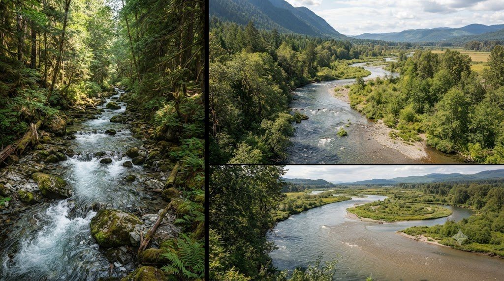
| Type A | < 1.4 (Entrenched) | < 12 (Deep/Narrow) | 1.0 to 1.2 (Straight) | > 0.040 (Steep > 4%) | High-gradient alpine mountain torrent; cascade/step-pool; low lateral adjustment |
| Type B | 1.4 to 2.2 (Moderately Entrenched) | > 12 (Moderate) | 1.2 to 1.4 (Low) | 0.020 to 0.039 (2%–4%) | Riffle-dominated bedrock/colluvial valley; stable banks; excellent restoration template |
| Type C | > 2.2 (Slightly Entrenched) | > 12 (Wide) | > 1.4 (Meandering) | < 0.020 (Gentle < 2%) | Classic meandering alluvial channel with well-developed broad floodplain; pool-riffle |
| Type D | N/A (Multi-thread) | > 40 (Extremely Wide) | Variable | < 0.040 | Braided river system with multiple shifting channels; extreme sediment bedload |
| Type E | > 2.2 (Slightly Entrenched) | < 12 (Very Deep/Narrow) | > 1.5 (High Sinuous) | < 0.020 (Gentle < 2%) | Stable, deeply incised meadow stream; dense turf bank root cohesion; high trout habitat |
| Type F | < 1.4 (Entrenched) | > 12 (Wide/Shallow) | > 1.4 (Meandering) | < 0.020 | Deeply entrenched, destabilized alluvial valley; actively eroding vertical cutbanks |
| Type G (Gully) | < 1.4 (Entrenched) | < 12 (Deep/Narrow) | 1.0 to 1.2 (Straight) | 0.020 to 0.039 | Unstable gully incised into alluvial fill; severe headcutting and downcutting |
Natural Channel Design: Cross-Vanes, J-Hooks, and Root Wads
Traditional river engineering combated erosion by lining banks with quarried rock (rip-rap), which accelerates downstream water velocities and destroys in-stream ecological habitat. Natural Channel Design (NCD) utilizes native boulders, gravels, and root wads to construct bioengineered structures that direct erosive energy away from vulnerable stream banks toward the center of the channel while creating deep aquatic habitat pools:
- Rock Cross-Vanes: U-shaped boulder structures keyed into the bed and banks pointing upstream. Water flowing over the weir crest converges toward the center of the channel, creating a deep downstream plunge pool while reducing shear stress against both banks to zero.
- J-Hook Vanes: Built along the outside of river bends to protect eroding cutbanks. The stem of the ‘J’ deflects high-velocity thalweg currents toward the channel centerline, while the curved hook creates gentle recirculation eddies and juvenile fish rearing pools.
- Root Wad Revetments: Large tree root fans placed along the lower bank embedded into footer logs and boulders. The complex root network absorbs hydraulic energy, halts bank retreat, and provides cover for salmonids and benthic macroinvertebrates.
Channel Evolution Models and the Path to Dynamic Equilibrium
When a river is disturbed, it undergoes a predictable multi-decade sequence documented by Schumm and Simon’s Channel Evolution Models (CEM): an undisturbed Type C stream incises into a Type G gully, widens into an unstable Type F canyon as banks collapse, and eventually deposits an inset floodplain over 30 to 50 years to re-establish a stable Type C or E configuration. Natural Channel Design accelerates this process, directly sculpting a stable cross-section that balances sediment supply with transport capacity, returning the river to dynamic equilibrium.
Bank Erosion Hazard Index (BEHI) and Near-Bank Stress (NBS) Modeling
To prioritize which degrading river reaches require immediate stabilization, Dave Rosgen developed the Bank Erosion Hazard Index (BEHI), an empirical multi-factor scoring matrix that evaluates stream bank susceptibility to geotechnical failure. A field surveyor evaluates five physical parameters along representative cutbanks:
- Bank Height Ratio ($BHR = H_{bank} / D_{bkf,max}$): The total vertical height of the bank divided by the maximum bankfull depth. A $BHR > 1.8$ indicates an incised terrace vulnerable to mass geotechnical gravitational slump.
- Root Depth Ratio ($RDR = D_{roots} / H_{bank}$): The vertical penetration depth of living plant roots divided by bank height. Deep woody tree roots provide tensile soil reinforcement.
- Root Density (%): The visual percentage of the bank face laced with cohesive living root fibers.
- Bank Surface Angle (Degrees): Vertical or undercut banks ($> 80^\circ$) score in the Extreme hazard class, while gently sloped banks ($< 45^\circ$) score Low.
- Surface Protection (%): The percentage of the bank armored by woody debris, native cobble, or turf mats.
Near-Bank Stress (NBS) Hydrodynamic Vectors
The biological BEHI score is directly multiplied by the Near-Bank Stress (NBS)—a measure of hydraulic energy concentrated against the bank toe during bankfull flow (estimated via velocity ratios, radius of curvature divided by bankfull width $R_c / W_{bkf}$, or local shear stress ratios). When an Extreme BEHI score coincides with an Extreme NBS vector along the outside of a meander bend, bank retreat rates can exceed 2 to 5 meters per year, dumping thousands of tons of sediment directly into sensitive downstream fish spawning gravels.
Channel Evolution Stages and Bankfull Dimensions Verification
When implementing Rosgen Natural Channel Design in a degraded urban or agricultural stream, restoration practitioners must calculate precise dimensional ratios derived from stable regional Hydraulic Geometry Curves (Regional Curves). Sizing a restored Type C or E channel based on arbitrary landscaping preferences rather than true drainage area bankfull scaling guarantees catastrophic blowout during the first two-year flood event.
For example, in a stable gravel-bed Type C4 stream draining a 15-square-mile humid temperate catchment, the bankfull cross-sectional area ($A_{bkf}$), bankfull width ($W_{bkf}$), and mean depth ($D_{bkf}$) must adhere to the empirical power-function relationships verified across regional reference reaches. The restoration design establishes a Meander Length Ratio ($L_m / W_{bkf} = 10 \text{ to } 14$) and a Radius of Curvature Ratio ($R_c / W_{bkf} = 2.0 \text{ to } 3.0$), ensuring that the natural helical secondary flow circulating through meander bends continuously sorts coarse gravels onto point bars without eroding bank toes.
Soil Bioengineering: Live Staking, Fascines, and Coir Log Revetments
Rather than relying on dead, sterile concrete walls, modern Natural Channel Design integrates living Soil Bioengineering. Dormant cuttings of native woody species (such as Black Willow Salix nigra, Sandbar Willow Salix interior, and Silky Dogwood Cornus amomum) are driven deeply into the active bankfull terrace as live stakes. Within weeks, the stakes sprout extensive root systems that lace through alluvial sediments, providing extraordinary geotechnical tensile reinforcement (root shear strength exceeding 15 to 40 kPa), while flexible above-ground stems bend beneath high-velocity flood flows, creating a protective boundary layer of vegetative roughness that suppresses erosion.
Field Hydrometry Protocols and Annual Catchment Survey Schedule
Field implementation of Rosgen Stream Classification and Natural Channel Design in a working river basin requires disciplined adherence to standardized hydrometry protocols. Stream channels exhibit profound temporal variability: baseflow conditions in late summer expose low-flow hydraulic geometries, while spring snowmelt and autumn convective storms mobilize bedload sediment and reshape gravel bars.
A professional lotic monitoring program coordinates cross-sectional surveying, velocity gauging, bed material pebble counts, and continuous water quality logging across four distinct hydrological stages. Use the operational field matrix below to align river surveys with annual hydrograph dynamics.
| Hydrological Stage | Flow Regime & Stage Height | Channel Energy & Hydraulic Focus | Mandatory Field Survey Protocol | Critical Safety & QA/QC Precautions |
|---|---|---|---|---|
| Early Spring Freshet | High Stage / Snowmelt Peak | Near Bankfull (High bed shear tau_0) | Deploy bridge-mounted ADCP or cableway winch for peak discharge Q | Never wade swift water; tether boat rigs; verify velocity sensor calibration |
| Post-Flood Late Spring | Receding Bankfull to Med Flow | Sediment sorting & bar deposition | Survey cross-sectional geometry at monumented pins; assess bank erosion BEHI | Inspect benchmark datum elevations; check monument stability against scour |
| Summer Baseflow (Dry Period) | Low Stage / Groundwater Fed | Subcritical tranquil flow (Fr < 0.3) | Perform 100-particle Wolman pebble counts; sample benthic macroinvertebrates | Wade along riffle transects; inspect periphyton cover; calibrate optical DO |
| Autumn Storm Pulses | Flash Stage Rises (Rain events) | Transient storage & organic drift | Measure suspended sediment concentration (SSC) & turbidity sonde spikes | Clean optical wiper blades on multi-parameter sondes; check solar battery voltage |
Wolman Pebble Count Standardization for Streambed Particle Sizing
Bed material size distribution ($D_{50}$, $D_{84}$) governs roughness, sediment mobility, and spawning gravel quality. To execute an unbiased Wolman Pebble Count (Wolman, 1954) across a representative riffle reach:
- Blind Sampling Geometry: Step along a zig-zag transect across the active bankfull channel. At each step, avert your eyes, reach down with your index finger at the tip of your boot, and retrieve the first particle your finger touches.
- Measuring the Intermediate Axis (b-axis): Measure the particle’s intermediate dimension ($b$-axis—neither the longest length nor the thinnest thickness) using a gravelometer template or precision caliper to the nearest millimeter.
- Cumulative Frequency Distribution (100 Particles Minimum): Tally particles into standard Wentworth size classes (<2mm silt/sand, 2–4mm, 4–8mm, up to >256mm boulders). Plot grain size on a log scale against cumulative percent finer to extract $D_{16}$, $D_{50}$ (median diameter), and $D_{84}$ for shear stress modeling.
Frequently Asked Questions Concerning Fluvial Dynamics & River Science
Why is bankfull discharge considered the most effective geomorphic flow?
While rare 100-year catastrophic floods move enormous boulders, they occur so infrequently that their cumulative geological work is limited. Conversely, everyday baseflows occur constantly but lack the shear stress required to move gravel. Bankfull discharge (occurring roughly every 1.5 years) balances moderate frequency with high sediment-transport capacity, performing the highest percentage of total annual bedload movement and sculpting permanent channel dimensions.
How does large woody debris (LWD) benefit stream hydraulics?
Large fallen trees and root wads increase channel boundary roughness, dissipating excess flood energy and preventing downstream bed incision. Furthermore, water flowing around log jams scours out deep, cold plunge pools that provide critical summer thermal refugia for trout and salmon while creating stable depositional gravel beds for spawning.
What is the difference between suspended load and bedload?
Suspended load consists of fine clays and silts held aloft in the water column by turbulent fluid eddies, traveling at nearly the same velocity as the flowing water. Bedload consists of coarse sands, gravels, and cobbles that roll, slide, and bounce (saltate) along the streambed, moving intermittently only when critical bed shear stress exceeds the Shields threshold.